Filed Under Ramsay

Ramsay Historic District

Ramsay Historic District

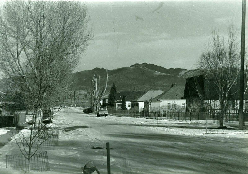
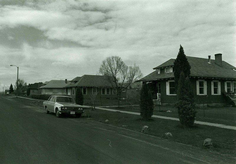
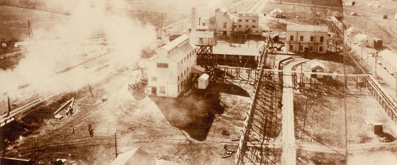
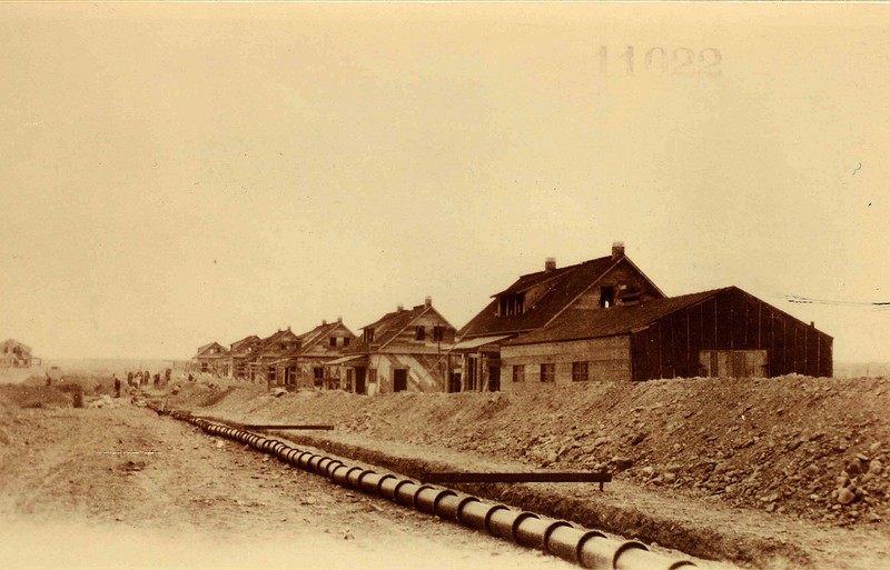
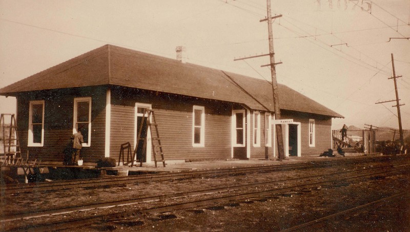
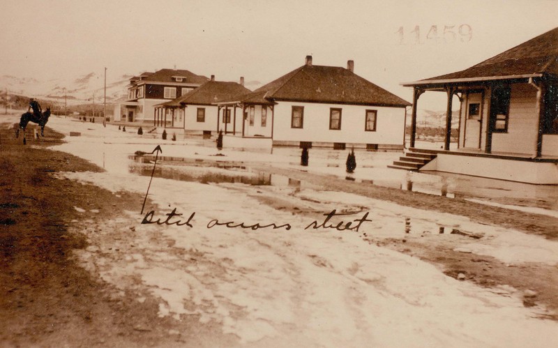
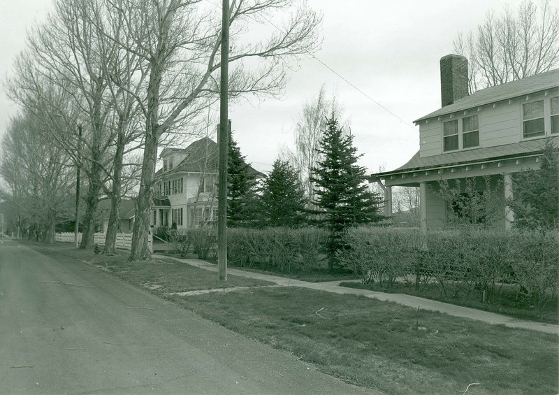
World War I (1914-1918) created an insatiable demand for copper, a primary component in warships, ammunition casing, and tanks. Since copper mining required explosives, in 1916 the DuPont Company decided to locate a dynamite manufacturing plant seven miles from Butte, home to rich copper mines. DuPont built the company town of Ramsay to attract workers to the isolated plant, which could produce 750,000 tons of dynamite a month. It situated Ramsay near the railroad, but far enough from Butte that an explosion—always a risk in a dynamite plant—would not affect the larger community. Believing that better living conditions resulted in greater worker efficiency, DuPont created a pleasant town with good infrastructure. Along wide, tree-lined streets the company built a large boarding house for single workers, attractive bungalows for married workers, and three large residences for company managers. The homes mainly followed three standard architectural designs, named after other DuPont company towns. Most common were the hipped-roof “DuPont-style” cottages, with a front hipped-roof dormer and small cutaway porches. The company also constructed six gable-roofed “Hopewell-style” cottages, with shed dormers and decorative shutters, and three smaller hipped-roof “Louviers-style” cottages. Demand for dynamite dropped precipitously after the war and DuPont closed the Ramsay plant in 1921. Throughout the 1920s, only three to four families lived in Ramsay. During the Great Depression, DuPont opened houses for non-company tenants. In the 1940s, DuPont sold the entire town to a former employee, who improved the houses and resold them to private buyers, transforming the company town into a Butte suburb.

Images

Ramsay Historic District
Ramsay Historic District Ramsay Historic District. Streetscape- View of South Laird Street and the DuPont Company executive's house, facing northeast. Source: Montana State Historic Preservation Office Creator: Mark Fiege Date: Mar. 1986
Ramsay Historic District
Ramsay Historic District Ramsay Historic District. Streetscape- East side of Laird Street with Louviers-style cottages, facing north. Source: Montana State Historic Preservation Office Creator: Mark Fiege Date: Mar. 1986
Ramsay Historic District
Ramsay Historic District Ramsay Historic District. Streetscape- West side of Palmer Street with DuPont-style cottages, facing south. Source: Montana State Historic Preservation Office Creator: Mark Fiege Date: Mar. 1986
Ramsay Historic District
Ramsay Historic District Ramsay Historic District. Historic Photo- General view of the Ramsay Explosives Plant. Village and contractors camp in background. Source: Montana State Historic Preservation Office Creator: P.F. Young Date: Sept. 1916
Ramsay Historic District
Ramsay Historic District Ramsay Historic District. Historic Photo- Panorama of the Ramsay Explosives Plant. Source: Montana State Historic Preservation Office Creator: P.F. Young Date: Sept. 1916
Ramsay Historic District
Ramsay Historic District Ramsay Historic District. Historic Photo- Hopewell cottages, facing south. Source: Montana State Historic Preservation Office Creator: W.J. Laird Date: Sept. 1916
Ramsay Historic District
Ramsay Historic District Ramsay Historic District. Historic Photo- B.A. & P. RR Station in Ramsay, facing east. Source: Montana State Historic Preservation Office Creator: P.F. Young Date: Oct. 1916
Ramsay Historic District
Ramsay Historic District Ramsay Historic District. Historic Photo- Flood picture, facing north. Source: Montana State Historic Preservation Office Creator: W.M. Boyle Date: Apr. 1917

Location

6.5 miles west of Butte on Interstate-90, Ramsay, Montana | Private

Metadata

Montana National Register Sign Program, “Ramsay Historic District,” Historic Montana, accessed April 28, 2024, https://historicmt.org/items/show/2686.