Filed Under Place

Stone Hill Springs Prehistoric District

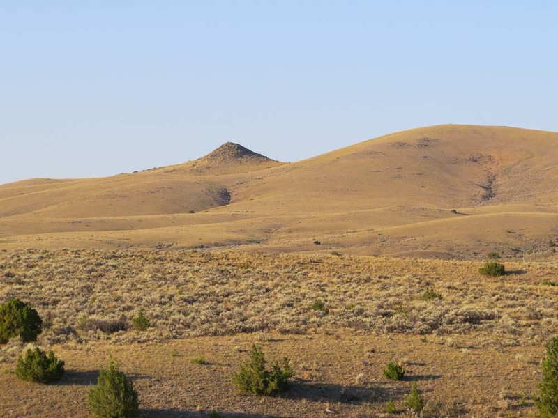
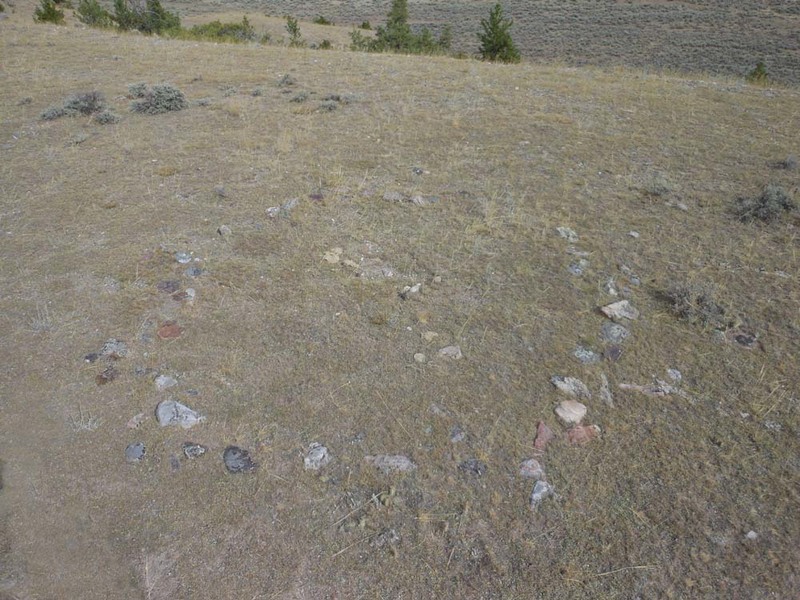
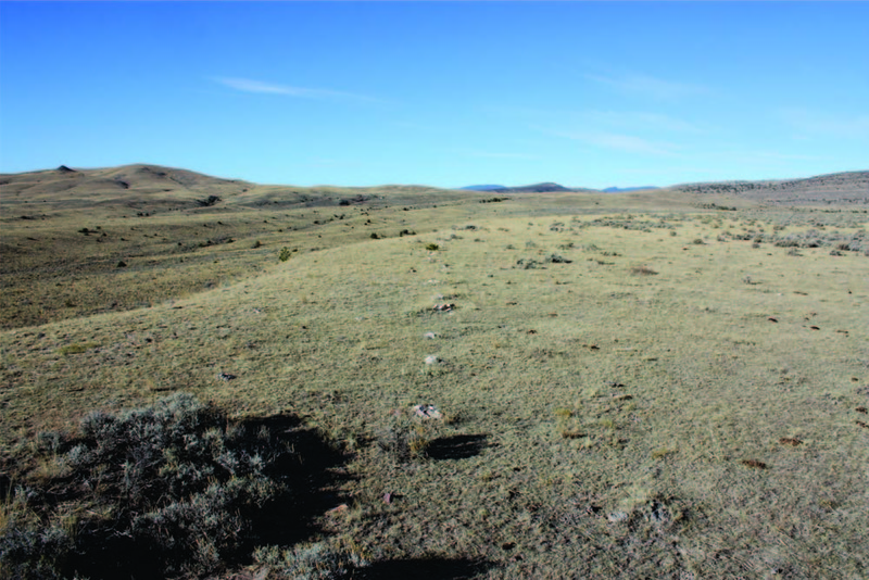
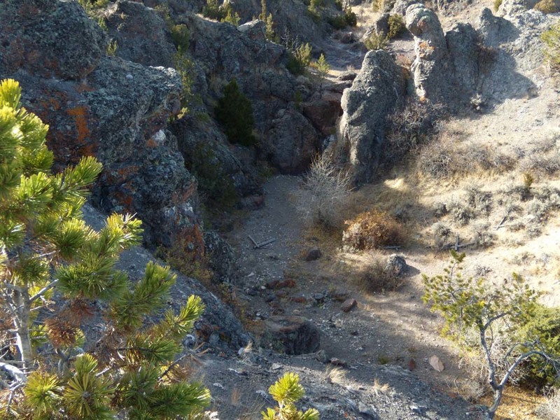
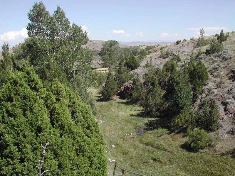
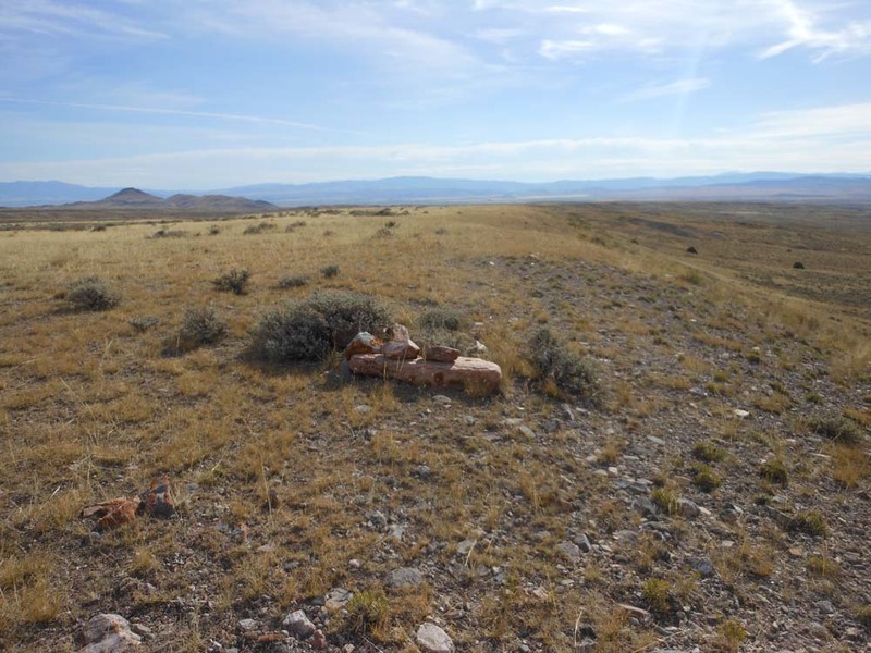
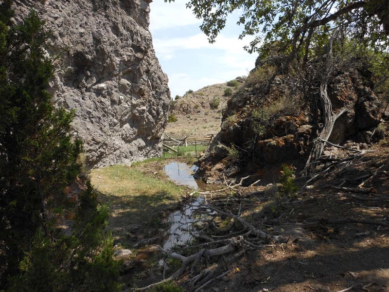
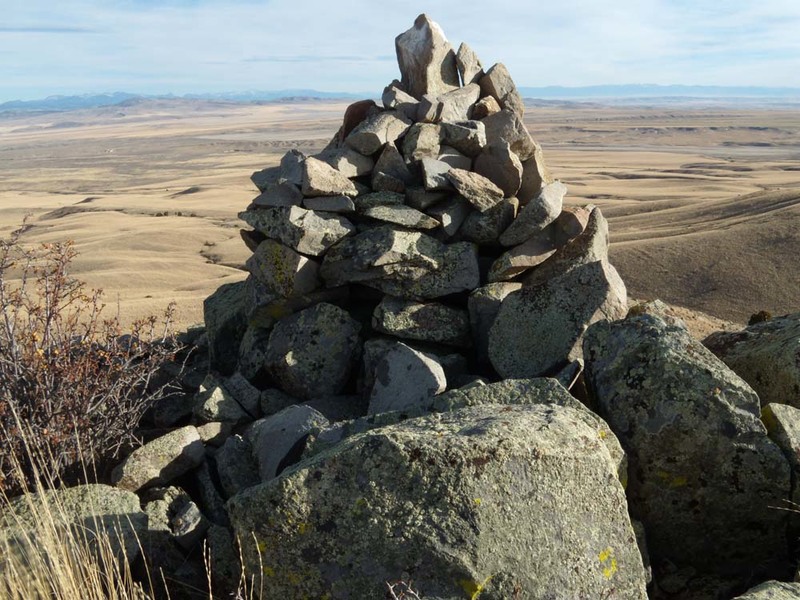
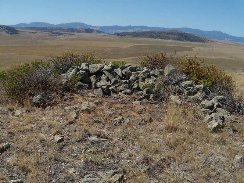
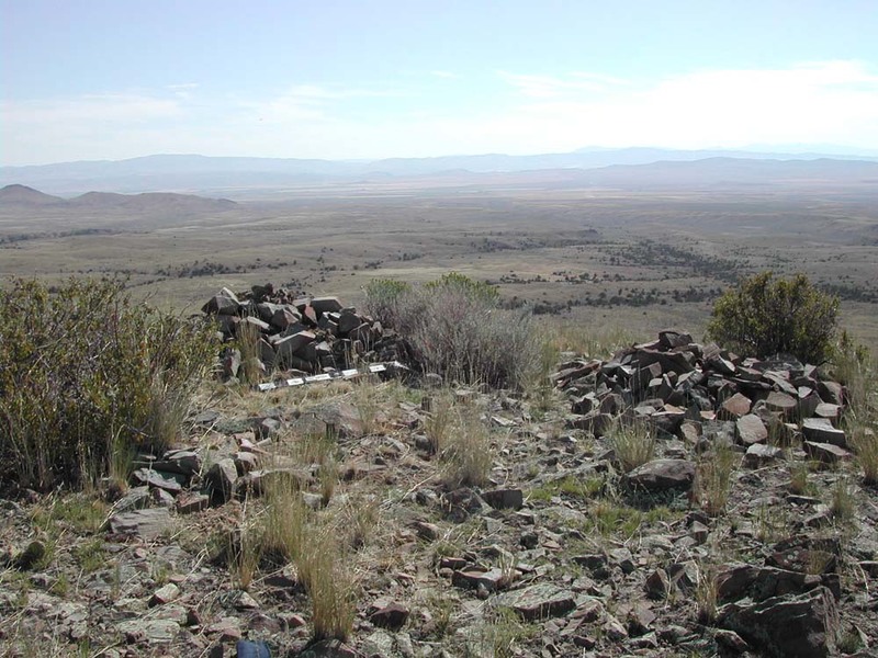
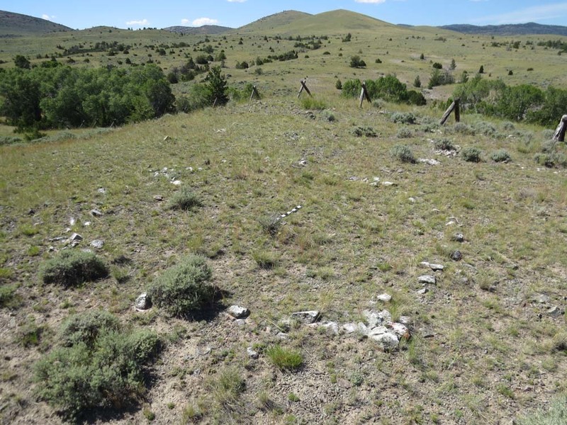
Numerous archaeological sites scattered over 2,000 unspoiled acres form a cohesive unit that together illustrate subsistence activities of Native people before contact with Euro-Americans. For the earliest people and tribes who later utilized the area, this landscape furnished amenities critical to survival. Its fresh-water springs and plentiful grasses attracted humans and wildlife. Its natural landscape also facilitated the hunting and processing of large numbers of bison. Before acquisition of the horse circa 1750, cliff-jumps and impoundments were typical means of procuring bison. The district includes a cliff jump, adjacent steep-sided impoundment area, extensive processing site, and a prominent ridge system providing overviews of the terrain and bison loafing area. Two converging drive lines of more than 300 strategically placed rock piles, or cairns, facilitated funneling bison over the cliff or into the impoundment area. Larger cairns positioned on knolls and a rock-walled blind on the ridge may have aided the hunt. A stone-lined pit likely functioned as an eagle catch and/or vision quest site. More than fifty stone rings, or circles, grouped into three major concentrations, indicate places where tipis were erected. Charcoal from the hearths in the processing area yield environmental clues about life in earlier eras. Maple, chokecherry, and willow—not found in the area today—along with juniper, provided nutrition, medicine, and building materials. The earliest discovered artifacts at Stone Hill date to 1500 B.C., but most span a period of use from A.D. 1167-1800. The district’s pristine foothill terrain and remarkable human-made features afford a rare opportunity to better understand the lifeway of the first Montanans.

Images

Stone Hill Springs Prehistoric District
Stone Hill Springs Prehistoric District Stone Hill Springs Prehistoric District. View of the location of the "Looking Out Place," facing south. Source: Montana State Historic Preservation Office Creator: Bob Haseman Date: Aug. 2013
Stone Hill Springs Prehistoric District
Stone Hill Springs Prehistoric District Stone Hill Springs Prehistoric District. View of a stone ring on the Stone Hill Springs Prehistoric District premises, facing northeast. Source: Montana State Historic Preservation Office Creator: Bob Haseman Date: Feb. 2012
Stone Hill Springs Prehistoric District
Stone Hill Springs Prehistoric District Stone Hill Springs Prehistoric District. View on the south end of southern drive line, facing west. The "Looking Out Place" Cairn is visible at the top. Source: Montana State Historic Preservation Office Creator: Bob Haseman Date: Nov. 2016
Stone Hill Springs Prehistoric District
Stone Hill Springs Prehistoric District Stone Hill Springs Prehistoric District. View from the top of the cliff looking down at the base of Trap Gulch with headwall, facing west. Source: Montana State Historic Preservation Office Creator: Bob Haseman Date: Feb. 2012
Stone Hill Springs Prehistoric District
Stone Hill Springs Prehistoric District Stone Hill Springs Prehistoric District. View of a possible impoundment location, facing east. Source: Montana State Historic Preservation Office Creator: Bob Haseman Date: Aug. 2013
Stone Hill Springs Prehistoric District
Stone Hill Springs Prehistoric District Stone Hill Springs Prehistoric District. View of a large individual cairn in the driveline, facing east. Source: Montana State Historic Preservation Office Creator: Bob Haseman Date: Aug. 2013
Stone Hill Springs Prehistoric District
Stone Hill Springs Prehistoric District Stone Hill Springs Prehistoric District. View of a breached dike near the processing area, facing east. Source: Montana State Historic Preservation Office Creator: Bob Haseman Date: July 2011
Stone Hill Springs Prehistoric District
Stone Hill Springs Prehistoric District Stone Hill Springs Prehistoric District. View of the Looking Out Place Cairn, facing southeast. Source: Montana State Historic Preservation Office Creator: Bob Haseman Date: Nov. 2010
Stone Hill Springs Prehistoric District
Stone Hill Springs Prehistoric District Stone Hill Springs Prehistoric District. View of the Looking Out Place Blind, facing west. Source: Montana State Historic Preservation Office Creator: Bob Haseman Date: Aug. 2011
Stone Hill Springs Prehistoric District
Stone Hill Springs Prehistoric District Stone Hill Springs Prehistoric District. View of three clustered cairns at 24BW1130, facing east. Source: Montana State Historic Preservation Office Creator: Bob Haseman Date: Aug. 2015
Stone Hill Spring Prehistoric District
Stone Hill Spring Prehistoric District Stone Hill Springs Prehistoric District. View of two stone circles connected by cairns, facing north. Source: Montana State Historic Preservation Office Creator: Bob Haseman Date: June 2017
Stone Hill Springs Prehistoric District
Stone Hill Springs Prehistoric District Stone Hill Springs Prehistoric District. View of a historic cabin, facing west. Source: Montana State Historic Preservation Office Creator: Bob Haseman Date: Mar. 2017

Location

Townsend, Montana | Private

Metadata

Montana National Register Sign Program, “Stone Hill Springs Prehistoric District,” Historic Montana, accessed April 20, 2024, https://historicmt.org/items/show/2678.