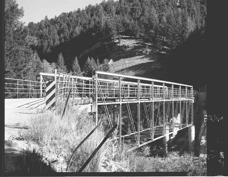
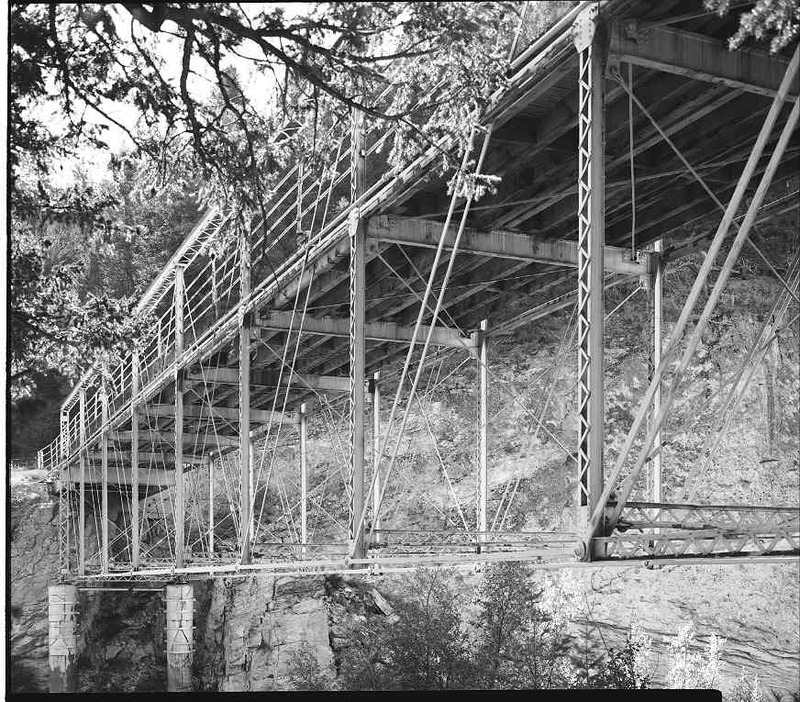
Dearborn River High Bridge
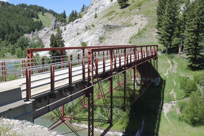
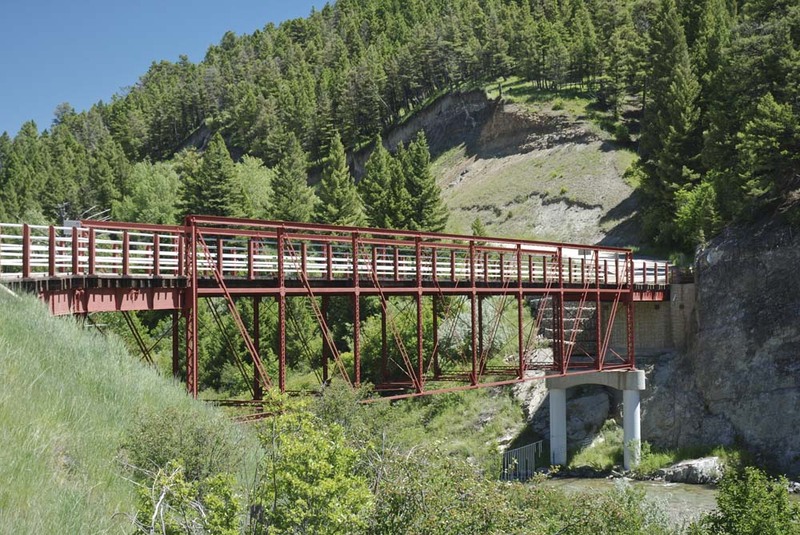
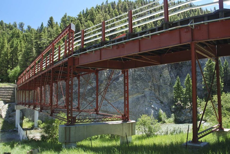
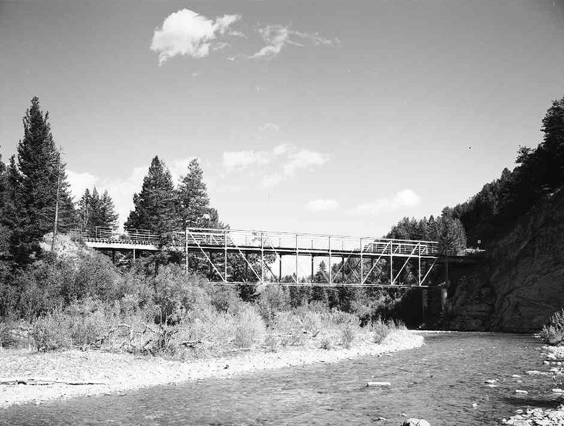
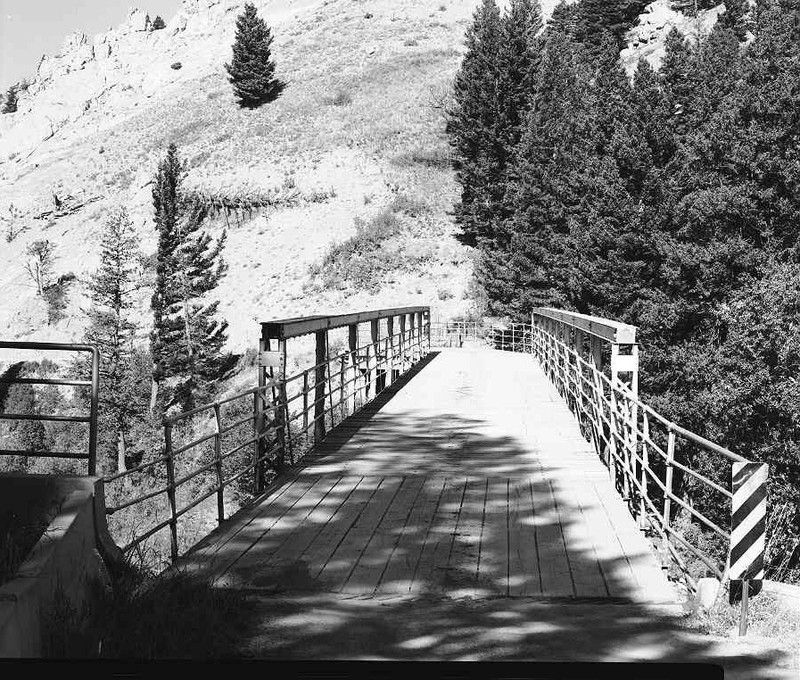
Generations of native peoples used this crossing in their seasonal travels to the Great Plains to hunt buffalo. Lewis and Clark christened the river after Secretary of War Henry Dearborn on their trek through the area in 1805, but its location in Blackfeet country left the valley long unexplored by whites. U.S. Army topographer P. M. Engel passed through in 1859 scouting the route for John Mullan’s military road. He described the remote timbered valley as difficult to maneuver, “…cut up by a great many sloughs and ditches.” Homesteaders later began to settle in the area with the completion of the Montana Central Railroad in 1887. Augusta, strategically located between Helena and Great Falls, became the local trading center. The Dearborn River High Bridge, built in 1897, provided critical access for homesteaders to the railroad in Augusta and Wolf Creek. Until the early 1930s, local farmers and ranchers transported goods and livestock across this bridge. This structure is the last surviving example of a pin-connected Pratt half-deck truss bridge in the United States. The design is unusual because the deck attaches midway on the trusses instead of at the bottom or top. The King Bridge Company of Cleveland, Ohio, tailored the design specifically to the Dearborn River Canyon to carry relatively light loads over the deep crossing. Lewis and Clark County and the Montana Department of Transportation restored the landmark bridge in 2003.
Images