Filed Under Helena

Helena Historic District

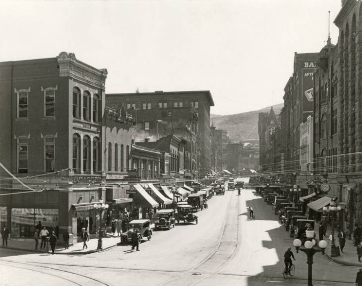
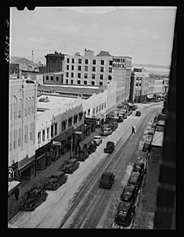
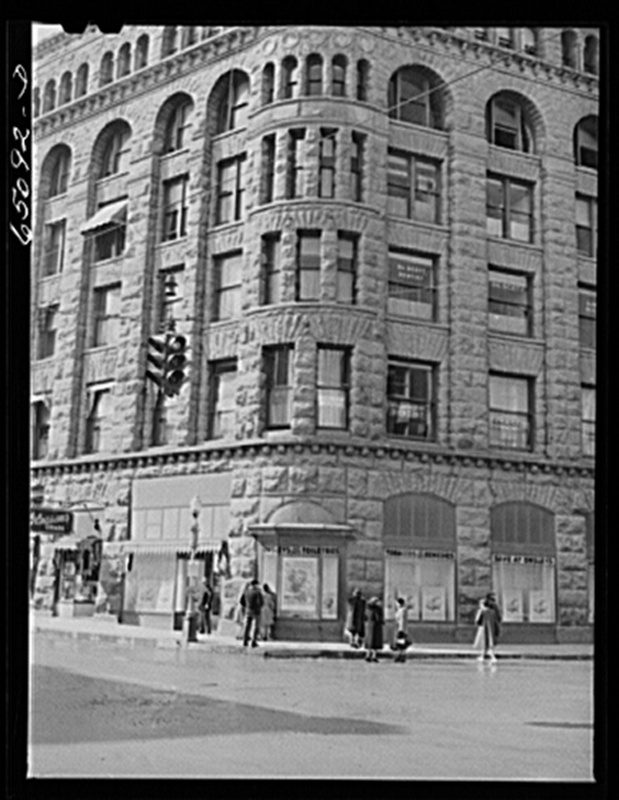
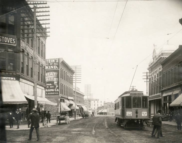
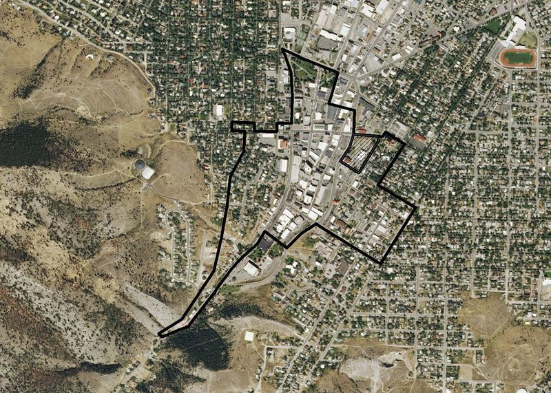
The crooked path of Last Chance Gulch, weaving between original mining claims, memorializes Helena’s chaotic beginning as a gold camp in 1864. Within a year of the placer gold discovery, a boomtown flourished, with homes and businesses in tents and log cabins. Fire was both constant threat and regular scourge. In 1869, the downtown burned, replaced over the next few years by brick and granite business houses. Helena survived after the placer gold played out and population declined, because pioneer entrepreneurs had made it a financial center. Helena claimed the territorial capital from declining Virginia City in 1874, and the following year received one of the nation’s five U.S. Assay Offices—acknowledgment of extensive hard-rock gold and silver mining that replaced placer mining. The arrival of the Northern Pacific Railroad in 1883, and Helena’s election as state capital in 1894, confirmed the town’s survival. Downtown buildings in a great variety of architectural styles arose, many since lost to fires, earthquakes, and urban renewal. The panic of 1893 and end of guaranteed federal silver purchases slowed Helena’s early momentum, but the gold camp that survived grew gradually as a business and government center.

Click here to tour the district.

Images

Helena Historic District
Helena Historic District Helena Historic District. View of Main Street in Helena, Montana, looking south at 6th Avenue. Automobiles line each side of the street and people walk on the sidewalks. Gans & Klein Co. (Goodkind) building on the left, Power Block on the right. Source: Montana History Portal Creator: Edward M. Reinig Date: Between 1924 and 1925
Helena, Montana
Helena, Montana Helena, Montana Digital ID: fsa 8c21417 Reproduction Number: LC-USF34-065034-D (b&w film neg.) Repository: Library of Congress Prints & Photographs Division Washington, DC 20540  Source: Library of Congress Prints and Photographs Division Creator: Vachon, John, 1914-1975, photographer Date: 1942 Mar
Helena, Montana. Office building
Helena, Montana. Office building Helena, Montana. Office building Digital ID: fsa 8c21472 Reproduction Number: LC-USF34-065092-D (b&w film neg.) Repository: Library of Congress Prints & Photographs Division Washington, DC 20540  Source: Library of Congress Prints and Photographs Division Creator: Vachon, John, 1914-1975, photographer Date: 1942 Mar
A. J. Seligman House
A. J. Seligman House Perspective view of main (east) and south elevations - A. J. Seligman House 802 Madison Avenue, Helena, Lewis and Clark County, MT Digital ID: hhh mt0024.photos.100550pCall Number: HABS MONT,25-HEL,10- Repository: Library of Congress Prints and Photographs Division Washington, D.C. 20540 Source: Library of Congress Prints and Photographs Division Creator: Huntsman, Al, photographer Date: May 1965
Helena Historic District
Helena Historic District Helena Historic District. View of a commercial section of Main Street, looking north from 6th Avenue with a street railroad or trolley car on the tracks in the street. Pedestrians walk along the sidewalks and numerous horse-drawn carriages are parked along the street in the distance. Source: Montana History Portal Creator: Unidentified photographer Date: ca. 1902
Helena Historic District
Helena Historic District Helena Historic District. Overview map of the historic district. Source: Montana State Historic Preservation Office Creator: Andrew Craft Date: June 2013

Location

Two major areas comprise the Helena Historic District. The first area is roughly bounded by Hauser Boulevard, Monroe Avenue, Stuart Street, Dearborn Avenue, Flowerree Street, and Madison Avenue. The second area is roughly bounded by Neill Avenue, North Last Chance Gulch, West Placer Avenue, Cruse Street, East Lawrence Street, North Ewing Street, 7th Avenue, North Rodney Street, East 6th Avenue, North Davis Street, East Broadway Street, South Cruse Avenue, Wong Street, South Park Avenue, the beginning of West Main Street, South Howie Street, North Howie Street, West Lawrence Street, Madison Avenue, Dearborn Avenue, North Benton Avenue, and North Park Avenue. Helena, Montana | Private | Public

Metadata

The Montana National Register Sign Program, “Helena Historic District,” Historic Montana, accessed April 18, 2024, https://historicmt.org/items/show/51.