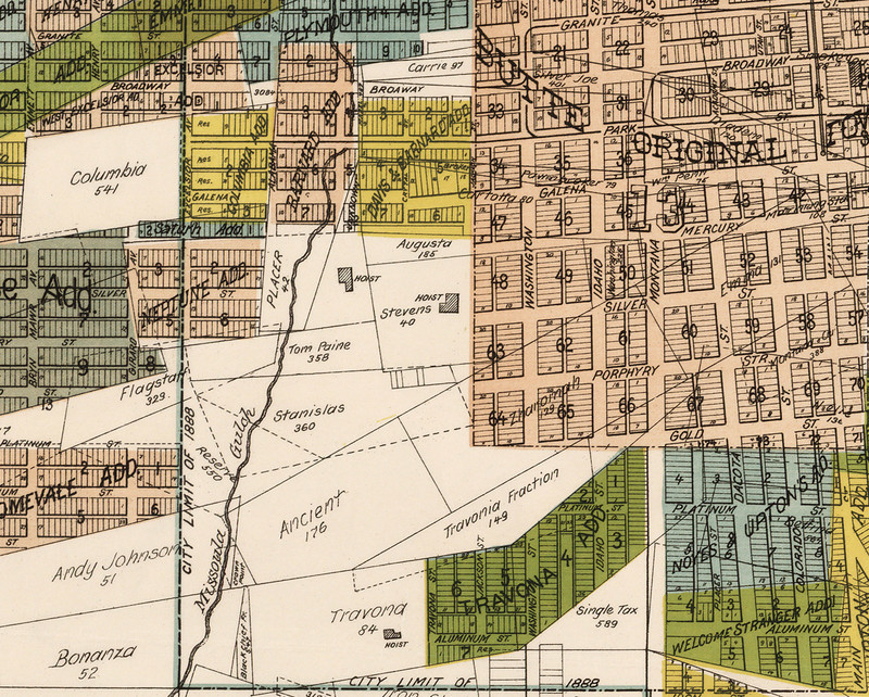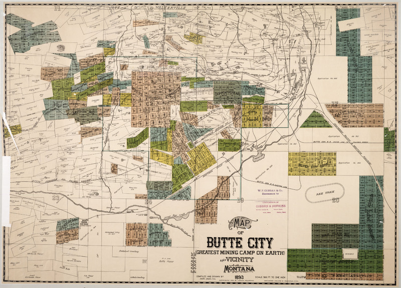
Discovery of rich silver deposits at the Travona, whose head frame still stands at the district’s west end, sparked Butte’s 1870s hard-rock mining boom. Most South Central buildings date from the 1880s and 1890s, after copper had supplanted silver as Butte’s economic engine. The Travona and nearby Emma Mine, now a city park, were also mined for zinc and manganese through World War II. Of the almost 500 houses still standing in this primarily residential neighborhood, over half were built before 1900 and almost a tenth were built before 1891. The earliest homes, clustered around Main Street near the central business district, are shotgun houses or simple worker’s cottages. Queen Anne style ornamentation—including bay windows, turned porch supports and mass-produced decorative details—embellish many of the district’s pre-1900 homes. Brick duplexes, built after the turn of the twentieth century, served the city’s growing population, as did the district’s four apartment buildings—including the highly decorated four-story Tripp and Dragstedt, built in 1916. The neighborhood’s diverse population worked as clerks, carpenters, teamsters, blacksmiths, lawyers, and architects as well as in the mines. Most residents congregated at meeting halls and churches in the nearby Central Business District, but this neighborhood did boast cultural institutions that appropriately reflected its heterogeneous population: the 1898 Scandia Hall (home of the Scandinavian Brotherhood), the African Methodist Episcopal Church (where Butte’s African American residents gathered), the 1897 Seventh Day Adventist Church (purchased by the Welsh Presbyterians in 1902), and the Jewish Temple Adath Israel (since demolished).
Images