Filed Under Laurel

Laurel Downtown Historic District

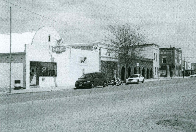
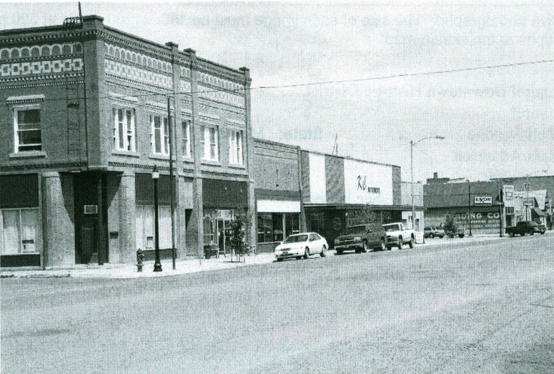
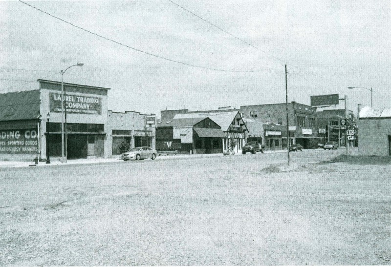
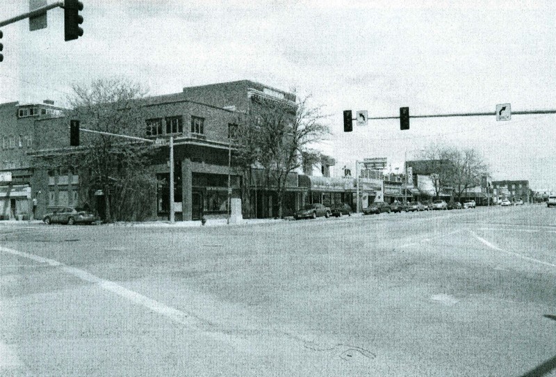
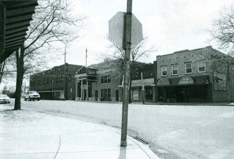
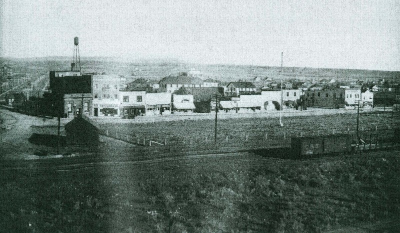
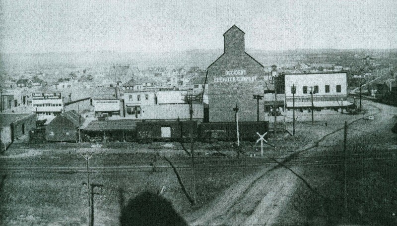
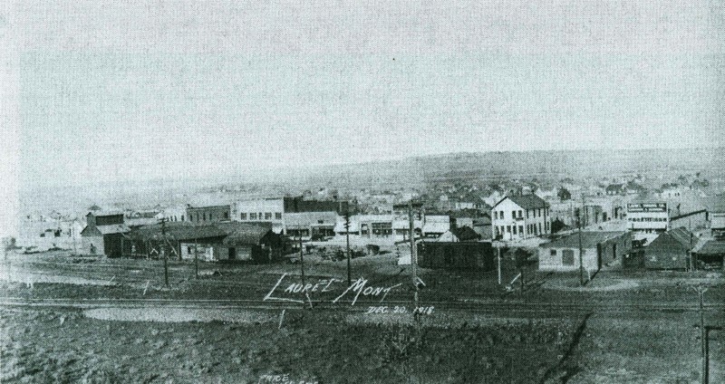
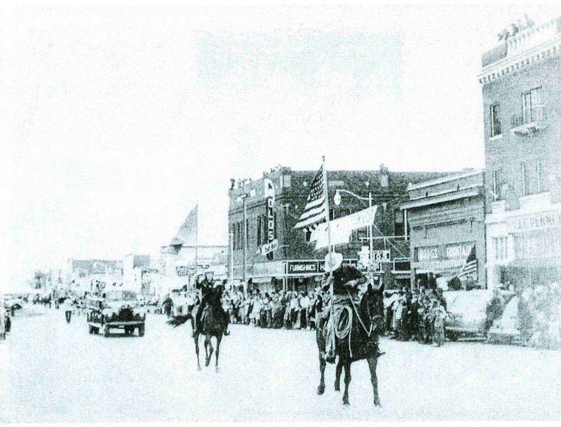
The Northern Pacific Railroad steamed through the Yellowstone Basin in 1883, passing the small agricultural community of Carlton. The town was renamed Laurel, and a post office opened there in 1886. When the Rocky Fork Railroad, an affiliate of the Northern Pacific, built a branch line to Red Lodge in 1889, it platted a new townsite at the junction nearby and Laurel residents relocated. The new Laurel was laid out as a typical railroad T-town; businesses sprang up along Main Street, parallel to the tracks.  The railroad and a sugar beet processing plant helped assure permanency, and in 1906, Laurel incorporated.  The Laurel Sentinel proudly invited the world to “watch Laurel grow” while boosters urged investors to come to Laurel where “a sure thing” awaited them.  By 1914, the Northern Pacific; Chicago, Burlington and Quincy; and the Great Northern railroads converged at Laurel. The town became the leading terminal between St. Paul, Minnesota, and Seattle, Washington. From 1910 to 1920, Laurel’s population nearly tripled. An oil refinery, built in 1929, added a third industry to railroads and agriculture, bolstering the economy during the depressed 1930s. Laurel’s downtown evolved accordingly, stretching to the east and west, spanning the period from 1906 to 1960. The district’s architectural patterns visually document Laurel’s evolution. Early boomtown false fronts represent the heart of the district. Western Commercial style brick storefronts and architect-designed business blocks illustrate the town’s emerging stability. Post-World War II modern structures at the district’s edges underscore how transportation, industry, and agriculture continued to fuel local commerce.

Click here to tour the district.

Images

Laurel Downtown Historic District
Laurel Downtown Historic District Laurel Downtown Historic District. View of 313, 309, 305, and 301 West Main Street with the beginning of the 200 block, facing southwest. Source: Montana State Historic Preservation Office Creator: Sara Adamson Date: June 2009
Laurel Downtown Historic District
Laurel Downtown Historic District Laurel Downtown Historic District. View of 217-221, 215, 213, and 207 West Main Street, facing southwest. Source: Montana State Historic Preservation Office Creator: Sara Adamson Date: June 2009
Laurel Downtown Historic District
Laurel Downtown Historic District Laurel Downtown Historic District. View of 119, 117, 113, 111, 109, 107, 105, and 101 West main Street, facing southwest. Source: Montana State Historic Preservation Office Creator: Sara Adamson Date: June 2009
Laurel Downtown Historic District
Laurel Downtown Historic District Laurel Downtown Historic District. View of 101, 103, 105, 107, 109, 111, 113, 115, 117, and 117 1/2 East Main Street, facing southwest. Source: Montana State Historic Preservation Office Creator: Sara Adamson Date: June 2009
Laurel Downtown Historic District
Laurel Downtown Historic District Laurel Downtown Historic District. View of 12, 16, 16 1/2, 18, and 18 1/2 1st Avenue, facing northwest. Source: Montana State Historic Preservation Office Creator: Sara Adamson Date: June 2009
Laurel Downtown Historic District
Laurel Downtown Historic District Laurel Downtown Historic District. View of the 100 block of East Main Street, facing southwest. Source: Montana State Historic Preservation Office Creator: Photographer unidentified Date: 1918
Laurel Downtown Historic District
Laurel Downtown Historic District Laurel Downtown Historic District. View of the 100 block of West Main Street, facing south. Source: Montana State Historic Preservation Office Creator: Photographer unidentified Date: 1918
Laurel Downtown Historic District
Laurel Downtown Historic District Laurel Downtown Historic District. View of the 300 and 200 blocks of West Main Street, facing south. Source: Montana State Historic Preservation Office Creator: Photographer unidentified Date: 1918
Laurel Downtown Historic District
Laurel Downtown Historic District Laurel Downtown Historic District. View of the 100 block of East and West Main Street, facing southeast. Source: Montana State Historic Preservation Office Creator: Photographer unidentified Date: 1940

Location

Bounded by Burlington Northern Santa Fe Railway company tracks to south, 3rd Street to north, Wyoming Avenue to east and 5th Avenue to west, Laurel, Montana | Private | Public

Metadata

The Montana National Register Sign Program, “Laurel Downtown Historic District,” Historic Montana, accessed April 24, 2024, https://historicmt.org/items/show/2170.